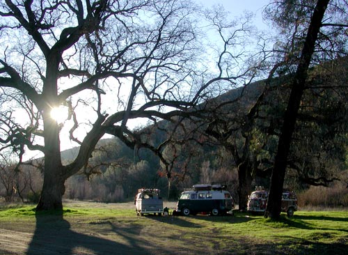
The Staging Area is once again at The Cache Creek Bridge ("Rampaging Spot"), Bartlett Springs Road, Lake County, CA (a few miles west of Indian Valley Reservoir)
Come prepared to camp in any weather. Bring at least 5 gallons spare fuel!!! Have a working CB!
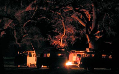
Arrive at Cache Creek Bridge (four wheel drive area) Thursday afternoon/evening (Jan 31st) to rampage, chill, fish, burn something, eat, sleep and wake early to depart at 4:30 am.
 The Cache Creek Bridge is 3-4 miles west of Indian Valley Reservoir, on Bartlett Springs Road, found on AAA's "Mendocino And Sonoma Coast" map in section J-9, or Page 76, C-1 in the N. Cal Delorme Atlas and Gazetteer.
From I-5, Williams, take Hwy 20 west to Bear Valley Road (a few miles after the road gets hilly and curvy). Bear Valley Road will take you north approximately 15 to 25 miles until you find Brim Road, a left turn. Find this stuff on the map before you try it for real. Brim Road (dirt and potholes start here) could possibly be missed if you aren't sure what to look for. Brim Road (west) turns into Bartlett Springs Road--follow up and over the hill...take no turns off the main road! At the top of the hill, you will find yourself at a four-way, unmarked intersection. Just keep going straight west. After a while, about 10 minutes after you pass the reservoir, you will come to the bridge over Cache Creek. Just past the bridge is the Staging Area. Look down to the left and to the right and you will see many busable trails and more than likely, some buses. On maps, you can pinpoint the staging area by looking for Indian Valley Reservoir, then finding Bartlett Springs Road (goes along the north side of the reservoir), and follow it west from the reservoir until the road crosses Casche Creek that feeds the reservoir from the west. That's the Staging Area.
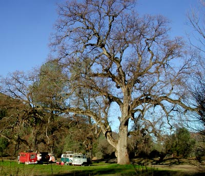
 This is what it might look like when you get there. If you are approaching from the Hwy 101 side, you can either take Hwy 20 east until you get to Bear Canyon Road (about 1 hour 45 minutes from 101) and then follow the directions stated previously, or you can access Bartlett Springs Road directly from Hwy 20 near Nice (about 2 miles to the east...a left turn (north). Neither way is fast, so forget about time...just get there. Going from Nice on Bartlett Springs Road is more adventurous and more fun but consult your maps. Basically, find Bartlett Springs Road from one side or the other and drive 'til you see another bus.
Advised: Get yourself a Delorme Atlas and Gazetteer for Northern California! Page numbers refer to that publication.
Most Important of All: Bring Your Brain. This trip is the real deal. This is where mistakes pile up and bite, complacency in driving threatens, and lack of preparedness kills; basically, you get 450 miles of chances to have an accident where you won't be found. You WILL be prepared.
Check out the helpful links below that lead to some crazy off road sites for fun ideas and interesting info and tips.
Below you can see what Shasta looks like right now.